November 9, 2012
Friday, November 9, 2012... 1:42pm (PST)
As of now, there is no tropical cyclone present inside the Philippine Area of Responsibility... An are of convection was located about 1,300 kms East of Samar island...More discussion on this system will be given later...

courtesy of NOAA
The major weather system affecting the country are Northeast Monsoon and the Inter-Tropical Convergence Zone (I.T.C.Z.)... Northeast Monsoon (a.k.a. Amihan) is affecting Northern Luzon right now... This will bring partly cloudy skies with passing, scattered light rainshowers in the said area... Light to moderate rainfall with total accumulated amount of about 40-50mm within the next 24 hours is expected in Batanes, Cagayan, Isabela and Aurora... Central Luzon will experience fair weather with isolated rainshowers that is associated with the moisture being brought by Amihan... 10-20mm of accumulated rainshower within the next 24 hours is possible in the said area... Southern Luzon and Bicol Region will experience mostly cloudy skies with scattered albeit passing rainshowers due to the cloudiness associated with ITCZ ... An average of 10-40mm of 24 hours accumulated rainfall is expected in the said area, with the exception of Camarines Norte where 50-60mm of rainfall is expected... Visayas and Mindanao will generally have cloudy skies with moderate rainshowers due to ITCZ... An accumulated rainfall amount of 30-60mm is expected in the next 24 hours...
The light to moderate wind will generally be coming from the NE and the seaboards will be moderate, with the exception of the seaboards in Northern Luzon where rough seas is expected... The area of convection outside PAR, NE of Palau is still trying to become organized... Convection is present in the said area with a modest divergence... Sea-surface temperature in the said area is warm (30°C)... The system is also in an area with low to moderate wind shear ... majority of the forecast models are not developing this system, on the other hand, they are suggesting a development near Mindanao... The Mindanao scenario shows a development of a disturbance (LPA) near Surigao... Over-all, there is only a 20% chance of a tropical cyclone formation within PAR in the next 48 hours...
-RLM
Posted by Roel Morelos.
November 8, 2012
Thursday, November 8, 2012. 5:23p.m. (PST) As of now, there is no tropical cyclone present inside the Philippine Area of Responsibility. But a low pressure system is present outside PAR, about 1,600kms East of Northern Mindanao.. Inter-Tropical Convergence Zone will cause moderate-heavy rainfall in Bicol Region, Visayas and Mindanao.. 40-80mm of accumulated rain (24 hours) can be expected in Bicol Region.. Samar and Leyte islands will recieve as much as 90mm of rainfall in the next 24 hours.. ... Continue reading...
Posted by Roel Morelos.
September 19, 2011
As of now, there is no tropical cyclone present within the Philippine Area of Responsibility. credits to:NOAA
 credits to: PAGASA Meanwhile, Southwest Monsoon blowing across Luzon and Visayas. Wind convergence affecting Mindanao. Majority of the country will experience mostly cloudy skies with scattered rainshower and thunderstorms. Light to moderate rainfall can be expected in these areas. The bulk of the rainfall is expected to affect western portion of Central and Southern Luzon as well as t...
Posted by Roel Morelos.
September 17, 2011
As of now, there is no tropical cyclone present within the Philippine Area of responsibility (PAR). TS ROKE lurking outside PAR; about 40 km. N of the PAR line. May enter PAR briefly but will exit again. Not a threat to our country. Meanwhile, Monsoon trough affecting Northern and Central Luzon. The moisture connected with the monsoon trough and further enhanced by TS ROKE covering much of the country. .jpg) Northern and Central Luzon, especially the areas facing west, will experience overcast sk... Continue reading...
Posted by Roel Morelos.
September 16, 2011
There is no tropical cyclone present within the Philippine Area of Responsibility. Meanwhile, TS ROKE-enhance Southwest Monsoon affecting a large part of Luzon. Monsoon trough affecting Southern Luzon and Visayas. Inter-Tropical Convergence Zone affecting Mindanao. The LPA East of Batanes is now being absorbed by TS ROKE. No longer a threat to our country.

Large part of Luzon, Eastern Visayas and large part of Mindanao will experience mostly cloudy skies with scattered rainshowers and thunder... Continue reading...
Posted by Roel Morelos.
September 14, 2011
As of now, Tropical Storm ROKE (18W/Onyok) had briefly re-entered PAR and is now on its way on going out again. One model guidance (GFS) is showing another possible re-entry that might happen next week, possibly Monday.But JTWC is stating that this is highly UNLIKELY (and i believe JTWC's reasoning). Despite of this, TS ROKE (18W/Onyok) is not expected to directly affect the country. Meanwhile, a Low Pressure Area was located at about 200km. E, NE of Basco, Batanes (based on the data from JM... Continue reading...
Posted by Roel Morelos.
September 13, 2011
Tropical Depression ONYOK [18W] Latest Data: Location: 1,170 km East Northeast of Basco, Batanes (PAGASA) Coordinates: 21.4°N, 134.7°E (PAGASA) Wind strength: 55kph (PAGASA and JMA) Accumulated rainfall near the center: 150-180mm (PAGASA and typhoon2000.com) Movement: (present) Moving W at 7kph (PAGASA) (forecast) WNW @ 4-7kph (PAGASA and typhoon2000.com) Links: PAGASA: http://www.pagasa.dost.gov.ph/ typhoon2000.com: http://www.typhoon2000.ph JTWC... Continue reading...
Posted by Roel Morelos.
September 13, 2011
As of now, there is 1 tropical cyclone present within PAR. For more details, please view the Tropical Cyclone Watch. Meanwhile, Inter-tropical Convergence Zone (ITCZ) affecting Bicol Region, Visayas and Mindanao.  Bicol Region, Visayas and Mindanao will have mostly cloudy skies with scattered rainshowers and thunderstorms. 40-50mm of rain is expected in these areas for the next 24hours. The bulk of the thunderstorm associated with the ITCZ is now covering Western Minadanao and Southern Visayas.... Continue reading...
Posted by Roel Morelos.
September 12, 2011
Tropical Depression 18W [pre-ONYOK] Present Data: 1550kms. East,Northeast of Basco, BatanesCoordinates: 21.3N, 135.0E (JMA)Wind strength: 55kphMovement: W @ 10kphLinks: PAGASA: http://www.pagasa.dost.gov.ph/ typhoon2000.com: http://www.typhoon2000.ph JTWC: http://www.usno.navy.mil/NOOC/nmfc-ph/RSS/jtwc JMA: http://www.jma.go.jp/en/typh/Forecast models:  credits to: wunderground.com  credits to: JTWC credits to: JTWC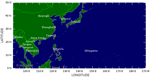 credits to: Tropical Storm Risk credits to: Tropical Storm Risk credits to: NOAA; link: http://www.emc.ncep.noaa.gov/gmb/tpm/emchurr... Continue reading... credits to: NOAA; link: http://www.emc.ncep.noaa.gov/gmb/tpm/emchurr... Continue reading...
Posted by Roel Morelos.
September 12, 2011
As of now, there is no tropical cyclone present within PAR. Meanwhile, monsoon trough together with the Inter-Tropical Convergence Zone affecting Luzon. This weather system is expected to bring light rains to Western Luzon especially to Region 1. Other than this, there is no other major weather system affecting the country. The rest of the country will experience partly cloudy skies with isolated rainshowers and thunderstorms especially in the afternoon and evening.
Albay: Partly cloudy to at ... Continue reading...
Posted by Roel Morelos.
|
|

